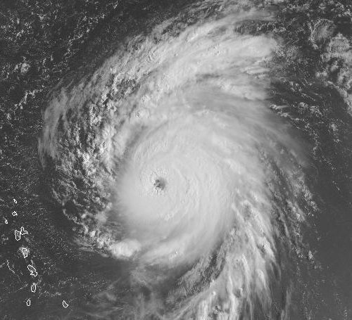
Hurricane Bill strengthened further overnight, and its top sustained winds are now estimated at 135 mph as of 5:00 AM EDT, making it a Category Four hurricane. It could be even stronger; data from a recon plane later today will give us a better idea of the storm’s strength. Here’s a visible satellite view this morning:
Further strengthening is expected. The forecast brings Bill up to 145 mph in 24 hours. Conditions will remain favorable for intensification for about the next 48 hours — though eyewall replacement cycles, which are inherently unpredictable, are likely to cause intermittent disruptions. Then, around 48-72 hours out, according to the discussion, Bill will begin interacting with the trough of low pressure currently off the Carolinas, so some weakening is expected. More rapid weakening will commence as Bill recurves in earnest and begins accelerating northward and northeastward.
Speaking of which… after the jump is a map showing the current “guidance envelope” of computer model forecast tracks.
As you can see, the models uniformly take Bill in between Bermuda and the U.S. East Coast. There’s still an outside chance of some impact on either the island or eastern Massachusetts, but it’s quite unlikely. Atlantic Canada is another story. The official forecast has Bill on the verge of landfall in Nova Scotia in 120 hours, as a Category 1 hurricane with 90 mph winds. After N.S., Newfoundland would seem to be next in line.


Pingback: hurricane categories – 海运女
Pingback: hurricane categories | sodini video