Katia, the storm that took Katrina’s place on the name list, is now officially a hurricane as of 11pm EDT, with winds of 75 mph. Hurricane Katia is expected to keep strengthening — to 100 mph in 1 day, 110 mph in 2 days, 115 mph in 3 days and 120 in 4 days (and it would hardly be shocking if she got even stronger, faster). It remains uncertain whether she’ll ever seriously threaten the U.S., though on balance, the more likely answer at this point seems to be “no.” But it’s just too early to say with a reasonable degree confidence. Any possible approach to the East Coast would likely occur no earlier than the weekend of 9/11, which is still an awfully long way off to be trusting computer models.
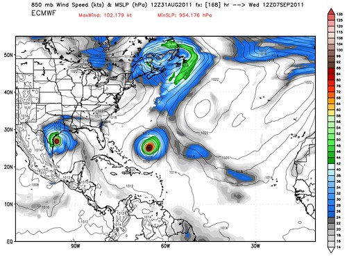
That said, if the current model tracks do roughly hold (a huge, huge “if” with such long-range forecasts), Bermuda could be under the gun sometime late next week. Here’s the prediction by one computer, the excellent European model, for a week from today:

There’s Hurricane Katia in the middle. But what about the storm at left? That would be Lee, currently known as “93L,” which the computer models have been predicting for several days now, and which the NHC is now watching, giving it a 60% chance of development in the next 48 hours. It’s unclear whether “proto-Lee” will become a serious hurricane threat to someplace along the Gulf coast, or just a big rainmaker, possibly in areas that could really use it. (Rick Perry’s prayers answered, perhaps?) The models are still vacillating wildly from run-to-run at this early stage.
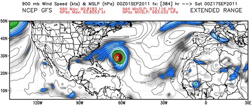
Lastly, long-range models like the 16-day GFS are calling for Hurricane Maria to form in 7-10 days, and basically follow Katia’s path near Bermuda and out to sea. Florida State meteorologist (and provider of these wonderful maps) Ryan Maue calls it a “conveyor belt of ‘fish storms.'”
Stay tuned, as they say.


It appears Katia is headed for Shetland, according to the GFS model, and may still be at hurricane strength, which does not bode well for the ponies. Brendan, Alasdair: Comments?